

West Contra Costa Transportation Commission
Richmond Parkway Transit Plan — Board briefing 1
The first of six briefings taking the Board through the study as it progressed.
Presentation · 2023 · 33 figures · about 5 min to read
The first of six briefings taking the Board through the study as it progressed.
Superseded — Kept for the record. A later document replaces it. Read the document that replaced it: Richmond Parkway Transit Plan
WCCTAC Board
Meeting #1
RICHMOND PARKWAY TRANSPORTATION PLAN May 26, 2023 www.wcctac.org Project Overview
Richmond Parkway Transportation Plan
Agenda
Project Overview Existing & Future Conditions Initial Findings Next Steps Public Engagement Approach
RICHMOND PARKWAY TRANSPORTATION PLAN
Project Overview
Richmond Parkway Transportation Plan
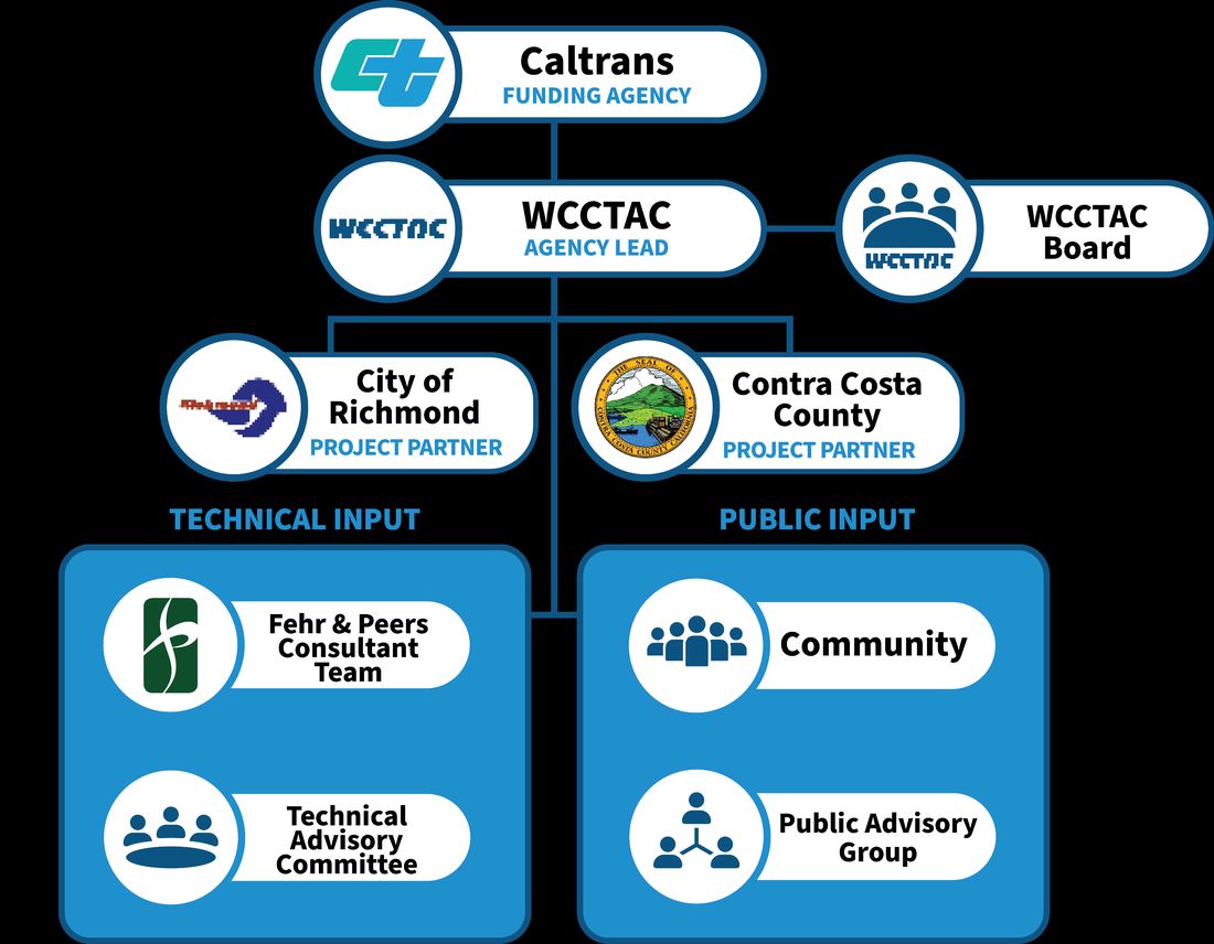
Project
Organization
Richmond Parkway Transportation Plan
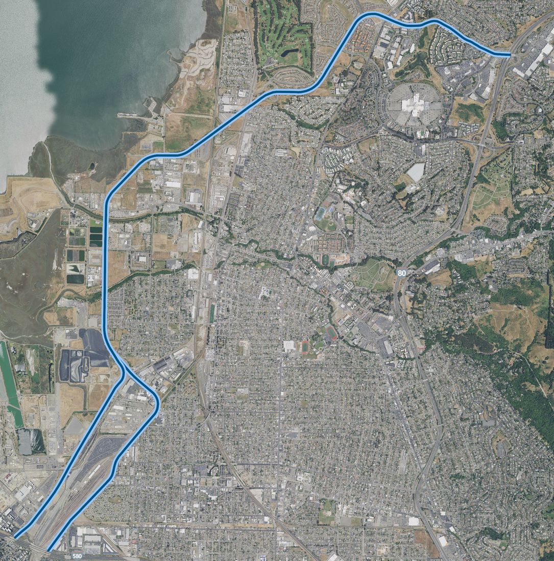
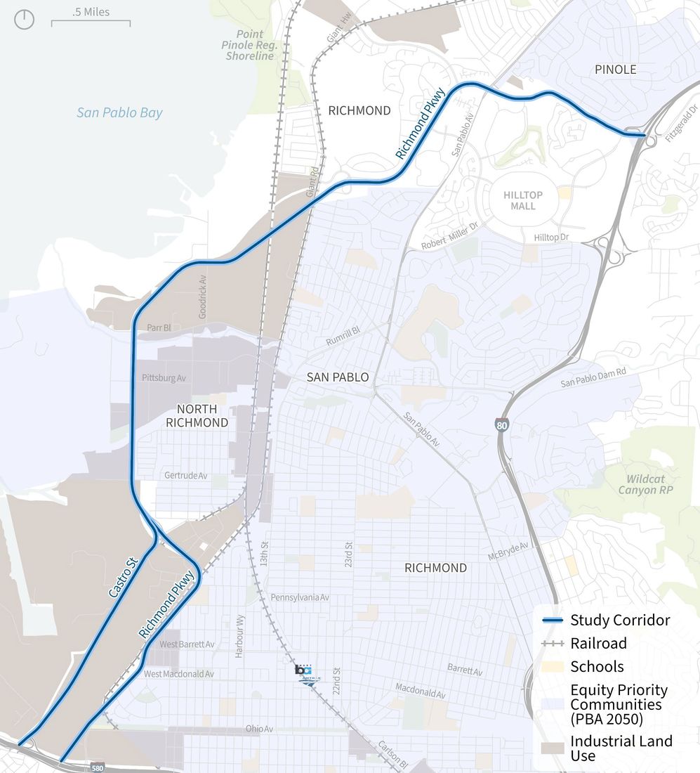
About the Project
Corridor
- Includes Richmond Parkway and
Castro Street between I-580 and I-80
- Falls within City of Richmond and
Unincorporated Contra Costa County
- Regional and local connector
- Includes segments of the Bay Trail
- Impacts Equity Priority Communities
- Planned industrial and residential growth
Original PDF, page 6
Richmond Parkway Transportation Plan
Project Objectives
Identify transportation needs faced by historically marginalized communities
Build community consensus
Coordinate on feasible and community-responsive projects with Contra Costa County, the City of Richmond, and other nearby jurisdictions
Reduce negative impacts of speeding, collisions, neighborhood cut-through traffic and localized pollution
Develop quality projects for people of all backgrounds, abilities, and ages
Improve safety and conditions for all modes within the plan area and encourage greater use of active transportation and transit
Increase access to regional trails, parks, employment, and educational opportunities Process Outcomes

Original PDF, page 7
Richmond Parkway Transportation Plan
Schedule
Opportunities for Public Input
RICHMOND PARKWAY TRANSPORTATION PLAN
Existing & Future Conditions
Initial Findings
Richmond Parkway Transportation Plan
Existing & Future Conditions Topic Areas
Safe Streets Public Health & Equity Transit Traffic Signals Land Use Climate Change Vehicle and Goods Movement Bike & Pedestrian Network
Richmond Parkway Transportation Plan
Existing & Future Conditions Topic Areas
Safe Streets Public Health & Equity Transit Traffic Signals Land Use Climate Change Vehicle and Goods Movement Bike & Pedestrian Network
Original PDF, page 11
Previous Safety Studies
Richmond Parkway Transportation Plan
Previous Safety Studies
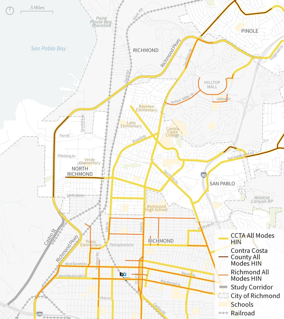
Recent safety studies have defined High Injury Networks (HINs) surrounding the study corridor:
- CCTA Contra Costa Countywide Transportation
Safety Policy and Implementation Guide (2021)
- Contra Costa County Vision Zero (2022)
- City of Richmond Local Roadway Safety Plan (2022)
What is an HIN? An HIN identifies corridors with the highest concentration of fatal and serious injury collisions. They can be multimodal or isolate crashes by mode.
Original PDF, page 13
Richmond Parkway Transportation Plan
Multimodal High Injury
Network
The multimodal HIN includes collisions of all modes: Vehicle, Bicycle, and Pedestrians. All three HINs underscore Richmond Parkway as a high injury corridor.
Source: Contra Costa Transportation Authority (2021); Contra Costa County (2022); City of Richmond (2022).
Richmond Parkway Transportation Plan
Bike & Pedestrian
High Injury Network
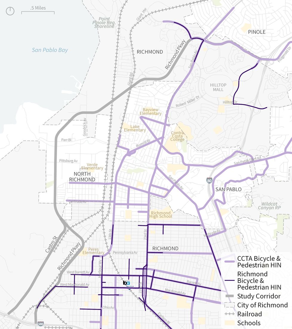
The northern and southern segments of the Richmond Parkway are on the bicycle and pedestrian HIN:
- Pedestrian HIN between the Bay
Trail and I-80
- Bicycle HIN south of Macdonald
Ave Note: Contra Costa County does not have a mode-specific HIN. Source: Contra Costa Transportation Authority (2021; City of Richmond (2022).
Original PDF, page 15
KSI Collision Trends
KSI = victim killed or severely injured
Richmond Parkway Transportation Plan
- 46 KSI collisions along the study corridor
21 resulted in a fatality
25 resulted in a serious injury
People walking and biking make up 6% of all injury collisions but 20% of KSI collisions and 24% of fatal collisions KSI collisions KSI Collisions by Year 4% 16% 80% Serious Injury Collisions 5% 19% 76% Fatal Collisions Bike Pedestrian Vehicle
KSI Collision
Trends
All Modes, KSI = victim killed or severely injured Source: TIMS, 2011 – 2020
Original PDF, page 17
Richmond Parkway Transportation Plan
KSI Collision
Trends
- Unsafe speed is the leading primary collision factor making up 28% of KSI collisions
- Hit Object is the top KSI collision type, which is consistent with unsafe speed
13 (28%) 7 (15%) 7 (15%) 6 (13%) 5 (11%) 8 (17%) Unsafe Speed Pedestrian Violation Traffic Signals and Signs Driving or Bicycling Under the Influence Improper Turning Other KSI Collisions Primary Collision Factor 15 (33%) 8 (17%) 7 (15%) 6 (13%) 10 (22%) Hit Object Vehicle/Pedestrian Broadside Rear End Other KSI Collisions Collision Type Source: TIMS, 2011 – 2020
Original PDF, page 18
Richmond Parkway Transportation Plan
KSI Collision Hotspots
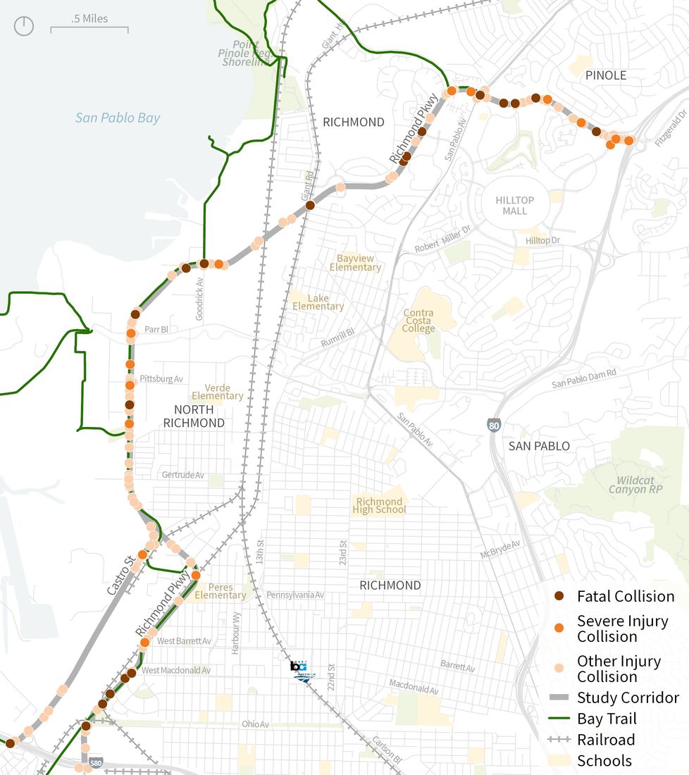
1. I-80 to WB Giant Rd Off-Ramp
- 15 KSIs: 5 fatal (1 ped), 10 severe injury
2. Within 650 ft of Goodrick Ave & Bay Trail
- 5 KSIs: 3 fatal, 2 severe injury
3. 800 ft north of Parr Blvd to Wildcat Creek Trail Underpass
- 6 KSIs: 2 fatal (1 ped), 4 severe injury
4. Hensley St to Ohio Ave
- 11 KSIs: 6 fatal (2 ped, 1 bike), 5 severe injury
4 segments along the corridor have concentrations of KSI collisions (9+ KSI collisions/mile) and should be focus areas for safety improvements.
Source: TIMS (2011-2020).
Original PDF, page 19
Richmond Parkway Transportation Plan The share of Black victims in KSI collisions is over 1.5x higher than the share of the Black population in the study area.
Who’s Most
Impacted by KSI
Collisions?
Source: TIMS, 2011 – 2020; ACS 2019 5-Year 0% 10% 20% 30% 40% 50% 60% Asian Black Hispanic White Other KSI Collision by Victim and Race All KSI Victims Bike and Pedestrian KSI Victims Study Area Population
Original PDF, page 20
Existing Walking & Biking Conditions
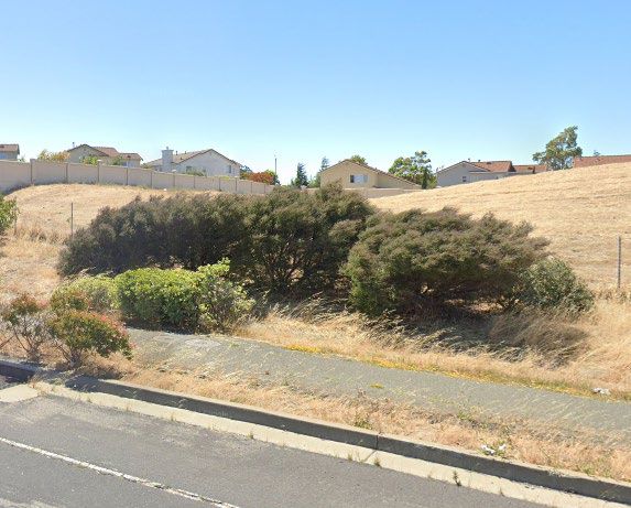
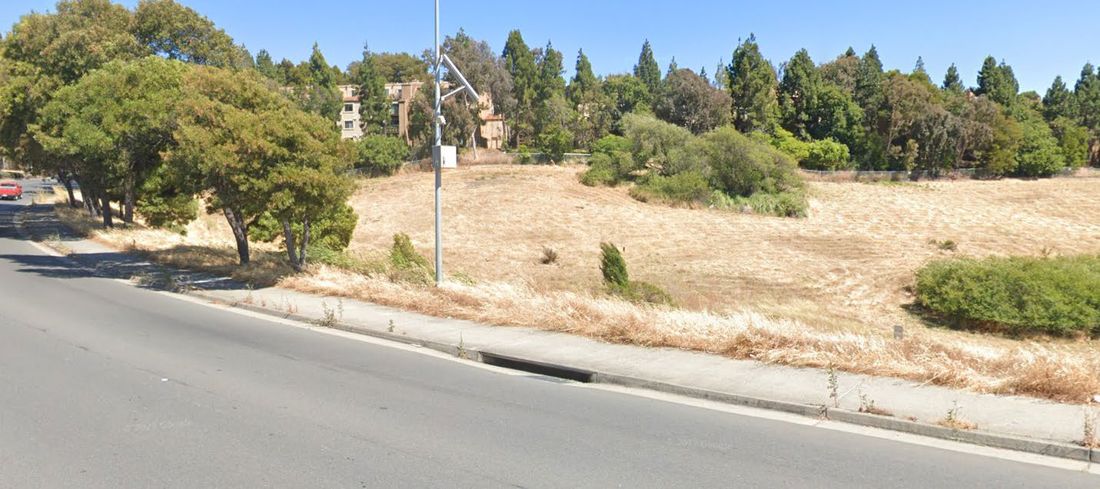
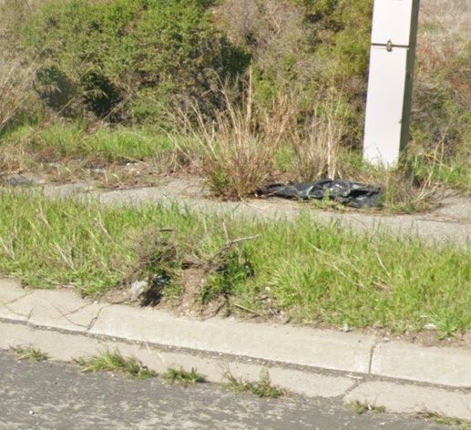
Richmond Parkway Transportation Plan
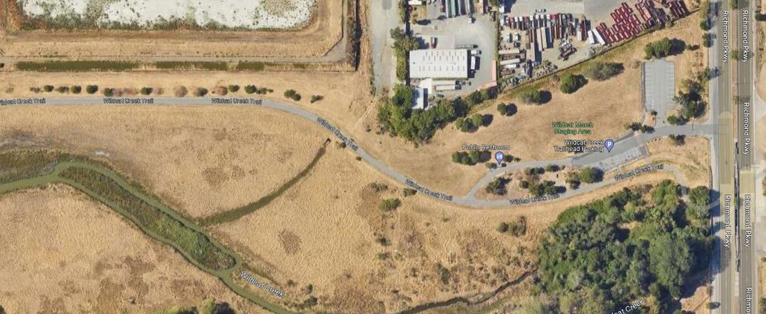
Existing Sidewalk and Trail Conditions
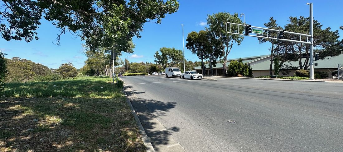
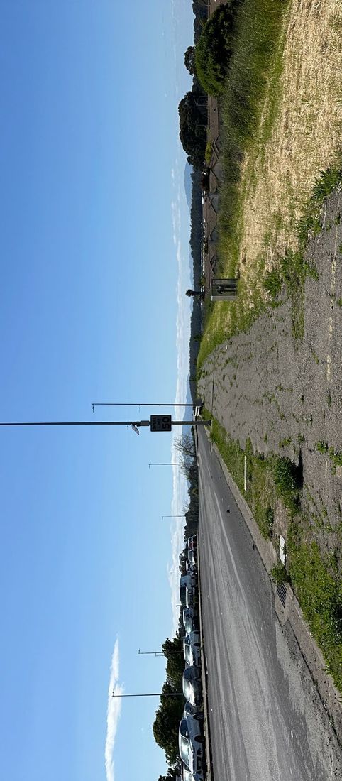
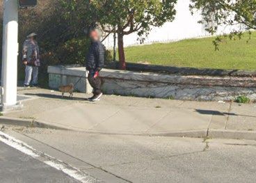
Limited shade in hot conditions Lack of trail lighting Small buffer between sidewalk and fast traffic Missing sidewalks near more active land uses Poor pavement quality There are opportunities improve the level of comfort on existing sidewalks and trail facilities corridor-wide.
Original PDF, page 22
Richmond Parkway Transportation Plan
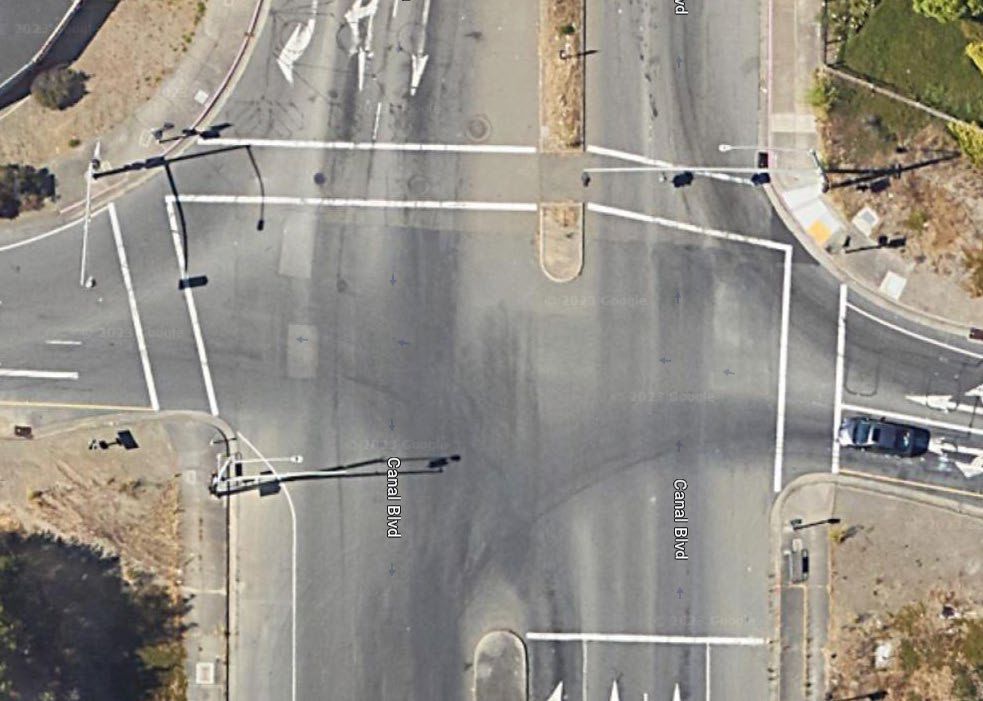
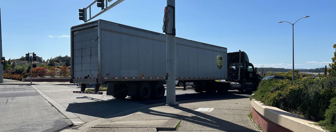
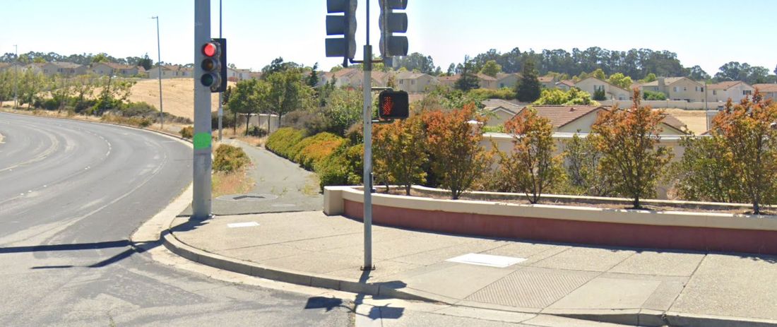
Existing Crosswalk Conditions
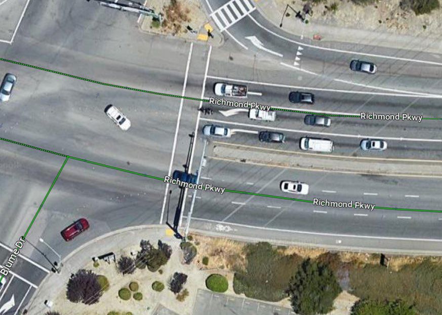
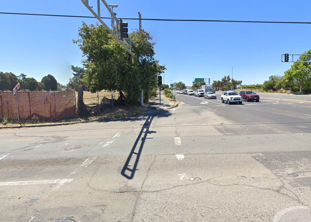
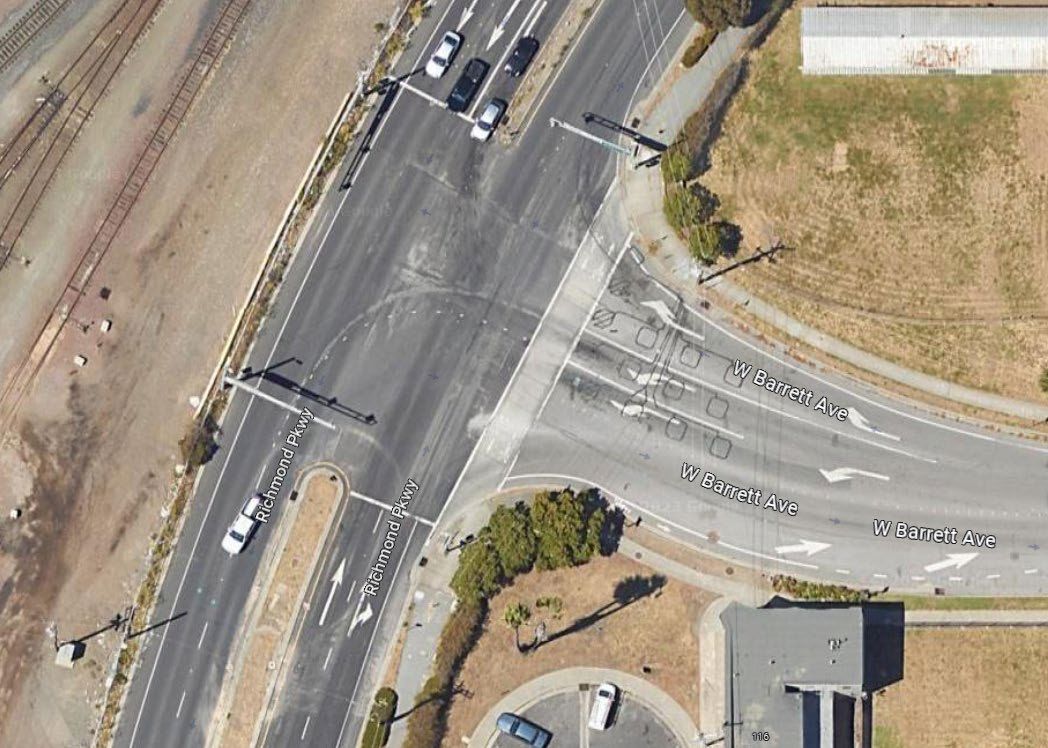
Bent crosswalks ADA non-compliant ramps Corner sight distance issues Outdated push buttons High vehicle turn speeds While crossing opportunities exist along the corridor at signalized intersections, safety and ADA improvements are needed corridor-wide.
Faded markings
Richmond Parkway Transportation Plan
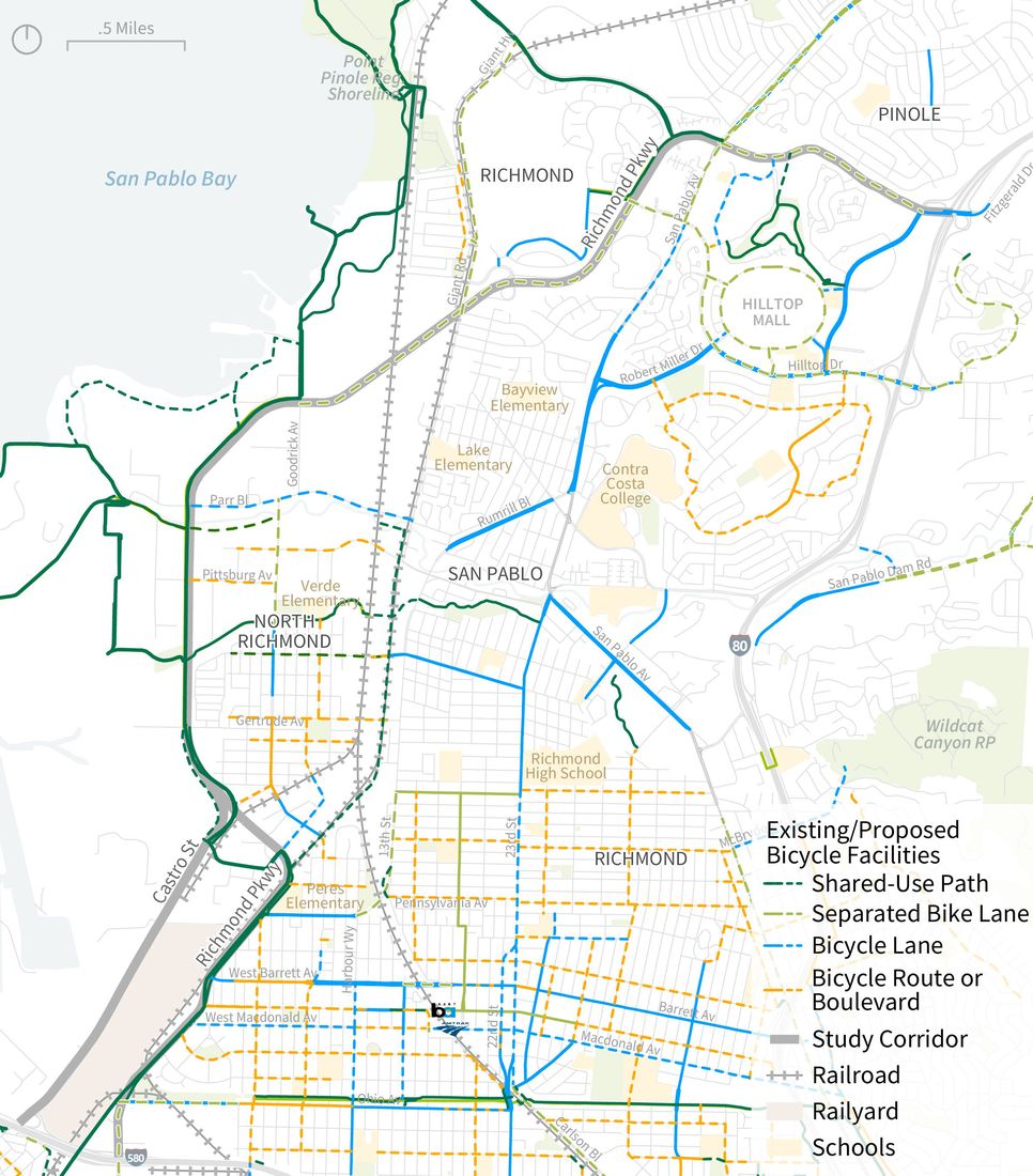
Existing and Proposed
Bike Network
- The Bay Trail is a major path for both bicyclists and pedestrians on the Parkway, connecting users to destinations across the Bay Area
- No bicycle facilities exist on Castro
St and Richmond Pkwy east of Goodrick Ave
- There is some existing connectivity to Hilltop Mall, North Richmond via
Wildcat Creek Trail, Peres Elementary, and Richmond BART Sources: Richmond BPAP (2023), Contra Costa County ATP (2022), CCTA Countywide Bicycle and Pedestrian Plan (2018)
Original PDF, page 24
Richmond Parkway Transportation Plan
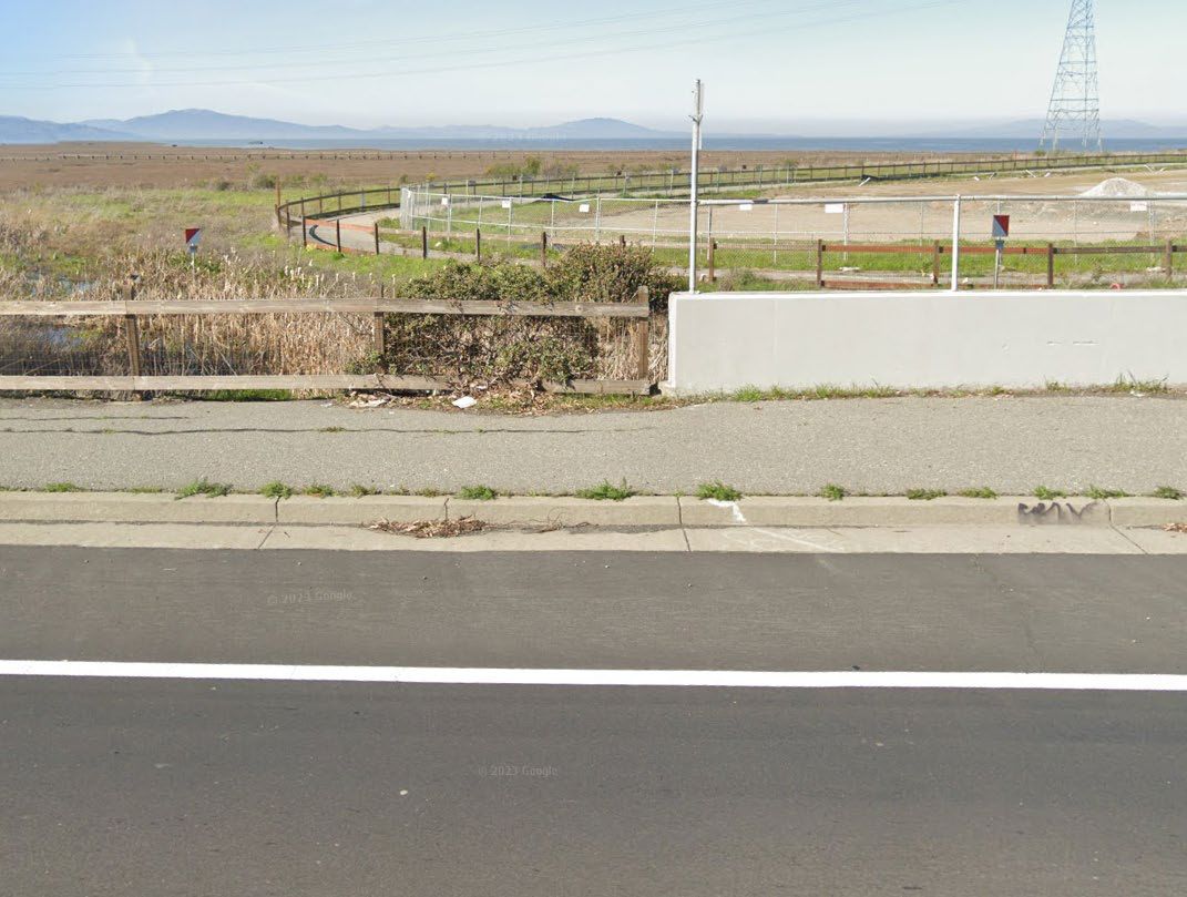
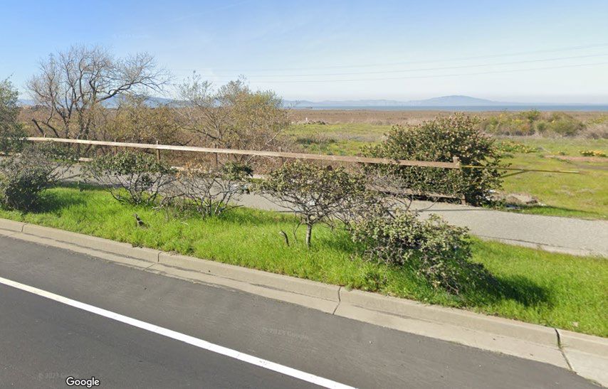
Existing Bike Conditions
Trail gaps force people onto high-stress routes Inconsistent buffer between bike trail and roadway Limited signage indicating shared-use path Bicycle lanes on the Richmond Parkway primarily consist of shared-use paths, although gaps in the path exist Low stress routes exist along Bay Trail but require detours
Original PDF, page 25
Richmond Parkway Transportation Plan
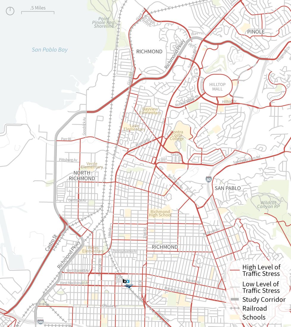
Level of Traffic Stress
Segments of the study corridor that do not align with the Bay Trail are currently high-stress for people biking, meaning the conditions are suitable for only “strong and fearless” adults.
Source: OpenStreetMap, 2023.
RICHMOND PARKWAY TRANSPORTATION PLAN
Public Engagement Approach
Richmond Parkway Transportation Plan
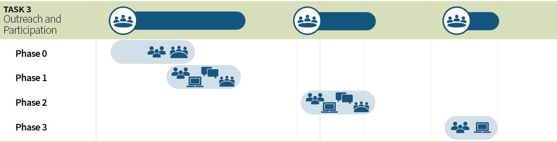
Public Engagement Schedule
Opportunities for Public Input
Original PDF, page 28
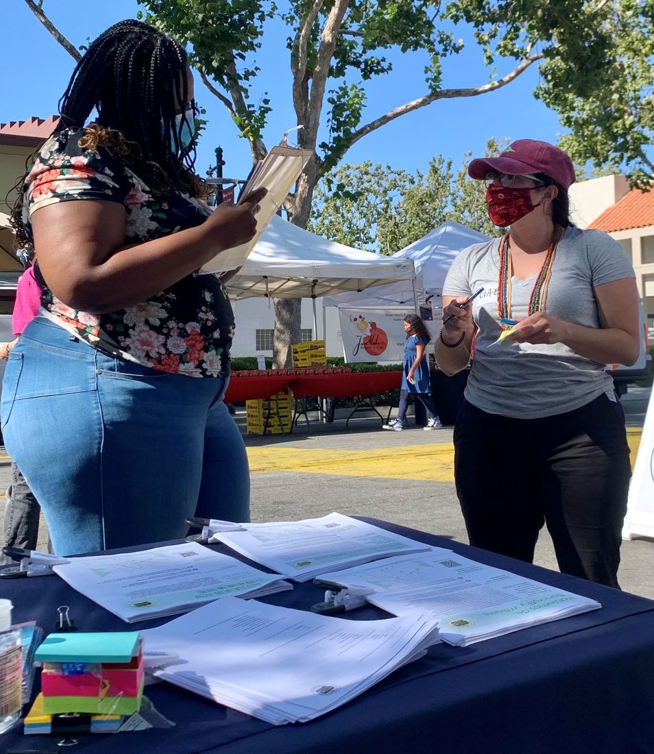
Pop-Up Engagement
Pop-Up Engagement is an effective approach to reach a broad range of community members, particularly lower-income communities of color, by meeting them where they’re at.
Potential locations may include farmers markets, churches, parks, etc. The project team will collaborate with the Public Advisory Group to identify these opportunities.
Original PDF, page 29
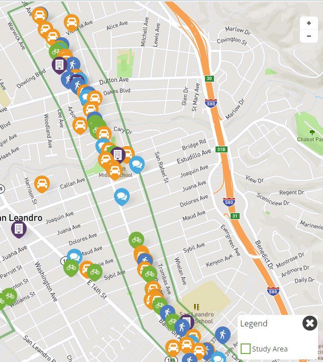
Digital Engagement
Digital Engagement consists of tools to solicit input from community members online, typically over a period of several weeks. Strategies may include:
- Online surveys
- Interactive webmaps
- Open comment forms
Richmond Parkway Transportation Plan
Phase 0 Public Engagement
Establish the Public Advisory Group and Public Engagement Plan Public Advisory Group Roster WCCTAC Board Meeting #1 Public Advisory Group Meeting #1 Draft Public Engagement Plan Final Public Engagement Plan May/June June April/May April ‘23
Original PDF, page 31
Public Advisory Group (PAG) Roster
Community/Public Health Groups
Groundwork Richmond
Urban Tilth
CHDC
Watershed Project Industrial/Trucking Groups
Port of Richmond
Industrial/Trucking Representative TBD Bike/Ped Groups
Trails for Richmond Action Committee (TRAC)
Bike East Bay Area/School Specific Groups
Richmond Neighborhood Councils
North Richmond Municipal Advisory Council
Richmond Parkway Transportation Plan
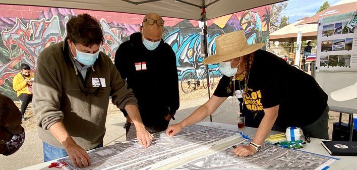
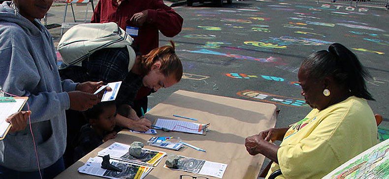
Draft Public Engagement Plan
Phase 1
Pop-up events and community meetings
Digital engagement
WCCTAC Board Mtg #2
PAG Mtg #2 Phase 2
PAG Mtg #3
Pop-up events and community meetings
Digital engagement
WCCTAC Board Mtg #3 Phase 3
PAG Mtg #4
Digital Engagement IDENTIFY NEEDS EXPLORE STRATEGIES REFINE SOLUTIONS
Original PDF, page 33
RICHMOND PARKWAY TRANSPORTATION PLAN
Next Steps
Richmond Parkway Transportation Plan
Next Steps
Existing and Future Conditions Assessment (Now-July ’23)
Phase 0 Engagement (Now-June ’23)
First Public Advisory Group Mtg on 6/8
Phase 1 Engagement (June ’23)
Thoughts/Questions?
Thank you
RICHMOND PARKWAY TRANSPORTATION PLAN
In the same set
The original file
Everything above is the content of the original document, published here as a web page so it can be read, searched, translated and used with a screen reader. The original PDF is kept as the authoritative record.